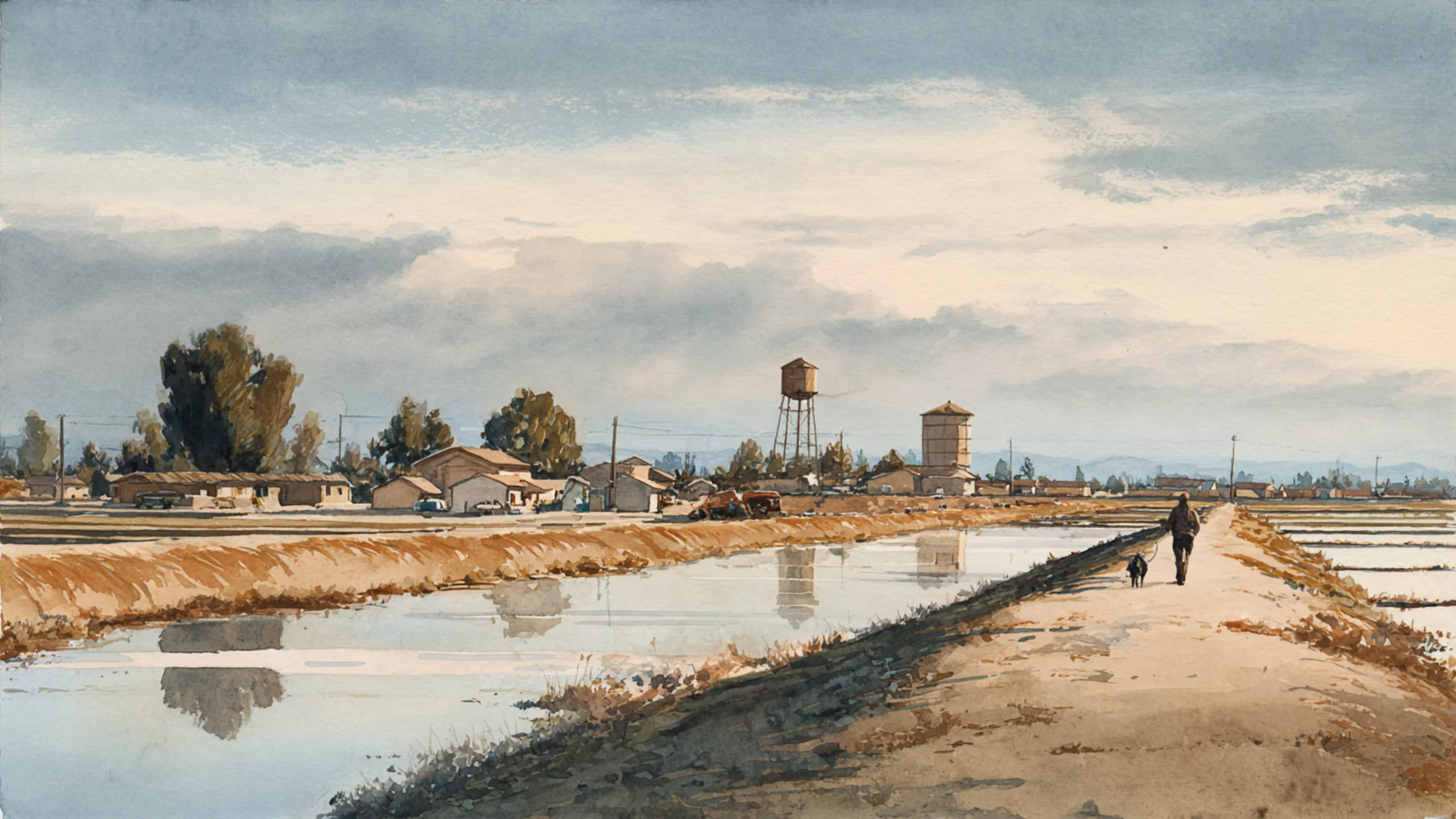
America's Borrowed Harvest: The Towns Holding the Groundwater Debt
Groundwater let American farming outgrow its rainfall. The towns built on that farming now carry the cost of paying the loan back, and the law in each state decides how fast it comes due.

Key Insights
Essential takeaways from this chronicle
The High Plains aquifer lost about 286 million acre-feet of recoverable water between predevelopment and 2019, about 10 percent of its storage. Texas accounts for about 170 million acre-feet of that loss and Nebraska for under 3 million.
Point 1 of 5Much of the water under the southern High Plains is fossil water, recharged mostly during the past 13,000 years, and about a third of all depletion has occurred in 4 percent of the aquifer's land area.
Point 2 of 5Subsidence at 2023 levels has reduced the capacity of the California Aqueduct by 44 percent, according to the Department of Water Resources. The groundwater pumped out of the Central Valley is damaging the canals that carry surface water to its cities.
Point 3 of 5In western Kansas, a locally initiated pumping cap in the Sheridan-6 area cut pumping by 36 percent between 2002-12 and 2013-22 and reduced the rate of water-level decline by about 65 percent, while irrigated area fell less than 3 percent.
Point 4 of 5Central Valley overdraft averaged about 1.1 million acre-feet a year in 2021-25, just over 40 percent below the 2003-10 benchmark, largely thanks to recharge in the wet winter of 2023. Groundwater storage has continued to decline since 2019.
Point 5 of 5
Corcoran, California, is protected by a levee fourteen and a half miles long.
In 1983, according to the news site SJV Water, its crest stood at 195 feet above sea level. By early 2017 it measured 188. Nobody had removed any earth. The levee had gone down with the town.
That year the levee was rebuilt to 192 feet, at a cost reported at between $10 million and $14 million. In 2023, as snowmelt refilled the old bed of Tulare Lake, the district set out to raise it once more. Before work began it stood at 188 feet: four feet lower than the rebuild, six years later. The district had about $1 million towards a job estimated at $17 to 21 million.
The ground under Corcoran is sinking because the water beneath it has been pumped out to irrigate the fields around it. NASA satellite imagery showed the area around the town dropping about two feet in 2015 alone. The town builds walls against the water that arrives in wet years while the water that leaves in dry years lowers the walls.
This is the American groundwater problem at the scale of a single street. Across the High Plains and California's Central Valley, farming has drawn for seventy years on reserves that rain does not replace. The fields still look green. The cost is turning up in the towns: in their levees, their taps, their municipal wells and the pipelines they are trying to build.
The harvest was borrowed. The towns are holding the loan.
A loan taken out around 1950
The High Plains aquifer lies under parts of eight states: Colorado, Kansas, Nebraska, New Mexico, Oklahoma, South Dakota, Texas and Wyoming. Its largest unit, the Ogallala, has become the name people use for the whole of it.
Large-scale pumping began around 1950. The US Geological Survey's most recent full accounting, published in 2024, puts the loss of recoverable water between then and 2019 at about 286 million acre-feet, roughly 353 cubic kilometres. That is about 10 percent of what was there. Averaged over the whole aquifer, the water table has fallen 16.5 feet. At the worst-hit well in the survey it has fallen 265.
An average of 10 percent sounds survivable. The average hides where the water went.
Bridget Scanlon and colleagues showed in 2012 that the water under the central and southern High Plains is largely fossil water, recharged mostly during the past 13,000 years. Recharge in Nebraska's Sand Hills runs about ten times higher than in Kansas or Texas. The depletion is concentrated accordingly: about a third of it has occurred in 4 percent of the aquifer's land area. Extrapolating the rates of the time, they estimated that 35 percent of the southern High Plains would be unable to support irrigation within thirty years.
Where recharge is that slow, pumping is mining. An inherited stock is converted into crops, cattle feed and income, and the stock does not come back on any timescale a farm loan cares about.
There is no single date on which the Ogallala "runs out". A well stops paying long before it stops producing. As the water table drops, each acre-foot must be lifted further, yields from the well fall, and at some point the electricity bill exceeds the margin on the crop. In 2026 the city manager of Hereford, in the Texas Panhandle, put the local arithmetic plainly: the aquifer under the town was declining about three feet a year, and its saturated thickness was around a hundred feet.
Three states, one aquifer, three laws
The aquifer is one body of water. The law that governs it changes at each state line, and the USGS figures change with it.
| State | Average water-level change, predevelopment to 2019 | Change in recoverable storage (million acre-feet) |
|---|---|---|
| Texas | −44.1 ft | −169.6 |
| Kansas | −27.3 ft | −72.0 |
| Nebraska | −0.4 ft | −2.7 |
Texas accounts for close to 60 percent of the aquifer's total loss.
Texas still follows the rule of capture, set down by its Supreme Court in 1904: a landowner may pump the water beneath their land without liability to the neighbours whose wells it drains. In Sipriano v. Great Spring Waters of America (1999), landowners in Henderson County alleged that a bottling plant pumping around 90,000 gallons a day had dried their wells. The court kept the rule. Texas law instead names local groundwater conservation districts as "the state's preferred method of groundwater management". Those districts write their rules inside a property-rights framework that treats the water as the landowner's to take.
Kansas allocates groundwater through permitted water rights, and since 2012 the state has allowed local areas to adopt binding pumping limits. Its experience is the subject of a later section.
Nebraska has governed groundwater since 1972 through 23 Natural Resources Districts with elected boards and state-approved management plans. Nebraska's favourable numbers owe a great deal to geology: the Sand Hills recharge ten times faster than the southern plains. Geology explains most of the gap between the three states. The law decides who may respond to it, and how quickly.
The town at the bottom of the well
The aquifer supplies farms, and in much of western Kansas and the Texas Panhandle it supplies the towns too.
"The Ogallala Aquifer is the only source of drinking water for Dodge City and many other towns in western Kansas," the Kansas News Service reported in December 2025. Dodge City has proposed to discharge treated wastewater into the dry bed of the Arkansas River so that it can seep back down into the aquifer the city drinks from. Garden City has adopted a similar closed-loop approach. Both cities describe the aim as becoming "water neutral".
Farmers are challenging the plan in court. In a state that allocates water by seniority of rights, a town's attempt to secure its drinking water becomes a dispute with the irrigators who hold the older rights.
Hays and Russell, further east, have spent the years since 1995 trying to bring water from the R9 Ranch in Edwards County, which Hays bought that year for its water rights. The plan is a pipeline of about seventy miles, costing around $120 million. It has been in litigation for years and has reached the Kansas Supreme Court.
Hereford's answer is the most direct: buy more water rights.
The pattern repeats across the plains. A town of a few tens of thousands sits on the same aquifer as the irrigators around it, and its water is subject to the same decline. To secure supply it has to buy water out of agriculture, recycle its own wastewater or pipe water in from elsewhere. Each of those options involves engineering, a court and a bond issue. A town with declining groundwater ends up as a water utility, a litigant and an infrastructure borrower, regardless of size.
A valley that sinks under its own canals
California's Central Valley farms on a more engineered system: rivers, reservoirs, federal and state canals, and beneath them an aquifer that makes up the difference when the canals run short. In 2023, according to the US Department of Agriculture, surface water supplied about 45 percent of irrigation water nationally. The rest came from the ground. In the Central Valley, the share from the ground rises in every drought.
The USGS estimated in 2024 that the valley lost about 158 cubic kilometres of groundwater storage between predevelopment and 2019, roughly 128 million acre-feet. About 15 percent of that is gone permanently. As the water came out, the clay layers that held it compacted, and compacted clay does not re-expand when water returns. The aquifer is now smaller than it was.
Above ground, the land drops. Some sections of the San Luis Canal have sunk more than eight feet since it opened in the 1960s. In 2017, subsidence of over ten feet in places cut deliveries from the Friant-Kern Canal by about 300,000 acre-feet.
The Department of Water Resources reported in November 2025 that subsidence at 2023 levels has reduced the capacity of the California Aqueduct by 44 percent. The aqueduct is the backbone of the State Water Project, which supplies cities from the Bay Area to San Diego. In May 2025 DWR found that subsidence had already cut the amount the project can deliver in a year by 3 percent. If no action is taken, it projects the project's long-term delivery capability falling by 18 to 87 percent by 2043. The 87 percent is the extreme case, which combines continued subsidence with severe climate change. DWR presents that range as the outcome its programmes are meant to prevent.
This is where farm groundwater reaches Southern California. Pumping in the valley lowers the canals that carry surface water to Los Angeles, and the cities on the coast inherit part of the valley's overdraft through their own supply.
Crop choices have made the overdraft harder to reverse. The Public Policy Institute of California found that perennial crops, mainly orchards and vineyards, grew from 22 percent of the state's irrigated acreage in 2000 to 46 percent in 2018. A tomato field can be left fallow in a drought year. An almond orchard cannot go unwatered without the loss of years of investment. PPIC says such crops "tend to harden water demands". Warmer temperatures raise evaporative demand and crop water requirements at the same time as they shrink runoff.
The shallow end
When the water table falls, the shallowest wells fail first, and in the valley the shallowest wells usually belong to houses.
Debra Perrone and Scott Jasechko examined more than two million well records across the western United States. They estimated that 3.5 percent of domestic wells went dry during 2013–15, against 2.8 percent of agricultural wells. Domestic wells fail disproportionately because they are shallower. In California's Central Valley this had previously been known mainly from anecdote.
East Porterville, an unincorporated community in Tulare County, provided the anecdote. Many of its wells were as shallow as thirty feet and depended on seepage from the Tule River. When the river ran dry in the drought, the wells followed. By 18 June 2015 California had recorded 1,908 dry wells affecting 9,540 people. About seven in ten were in Tulare County, and nearly four in ten were in East Porterville alone.
The state solved East Porterville's water problem by bringing the community into the city's system. It helped fund a $48 million project to connect homes to the City of Porterville's municipal water supply. The first homes received water in August 2016. By February 2018, 755 were connected.
Seventy years of farm pumping created the emergency, and annexation to a city water network ended it. A rural community that had drawn its water from its own wells became a customer of a city utility. Other communities on the valley floor whose wells are drying will need the same arrangement.
The efficiency trap
The usual answer to scarcity is better irrigation equipment, and on the High Plains it has been tried at scale.
Lisa Pfeiffer and C.-Y. Cynthia Lin studied western Kansas farms that switched to more efficient centre-pivot systems with dropped nozzles. They found, in a 2014 paper, that the conversion increased groundwater extraction on average, partly because farmers moved to thirstier crops. Each acre-foot now grew more, which made growing more worthwhile.
The hydrology adds a second problem. Water applied to a field that the crop does not use partly soaks back into the aquifer or runs into a stream. A more efficient system cuts that loss, so the meter shows a large saving while consumption across the basin falls far less. A 2024 study in Nature Communications used satellite estimates of evapotranspiration, the water that actually leaves the system through crops and soil, to map consumption field by field across California. It found that changing practices without changing land cover could save up to 11 percent. Changing crops could save far more.
Efficiency saves water only where a limit on pumping turns the saving into water left in the ground.
Sheridan County, Kansas, shows the difference. In 2013 a locally initiated plan became the state's first Local Enhanced Management Area, a binding cap covering 63,057 acres. The target was a 20 percent cut. According to the Kansas Geological Survey, pumping fell from an average of 29,925 acre-feet a year in 2002–12 to 19,104 in 2013–22, a 36 percent reduction, and about a quarter after adjusting for weather. The rate of water-level decline fell from 1.4 feet a year to 0.6. Irrigated area fell by only 2.7 percent: farmers kept farming the same land and applied less water to each acre.
The water table is still falling, more slowly. The cap bought time and did not reach balance. Sheridan-6 is still the clearest evidence on the plains that irrigators will accept a binding limit and keep their farms.
One wet winter
The latest figures are better, mainly because of the weather.
Kansas reported in April 2026 that its High Plains wells rose an average of about 0.2 feet in 2025, the first overall rise after five consecutive years of decline. The Survey credited timely rains during the growing season. In southwest Kansas, home to Dodge City and Garden City, levels still fell 0.62 feet.
In California, PPIC reported in 2026 that Central Valley overdraft averaged about 1.1 million acre-feet a year in 2021–25, compared with 1.9 million in its 2003–10 benchmark: a decline of just over 40 percent, even though the period includes two drought years. The likely reason was managed and natural recharge in the very wet winter of 2023. The same analysis notes that the 2023 wet year offset only about half of the nearly 14 million acre-feet lost since 2020. In 2025, an average year, the valley lost about 1.7 million acre-feet.
The weather made most of the difference. The years ahead will show whether management can hold the gains through the next drought.
Retiring the fields
California has set the deadline for that test. The Sustainable Groundwater Management Act of 2014 requires critically overdrafted basins to reach sustainability by 2040, and the remaining high- and medium-priority basins by 2042. PPIC estimates that projects already completed by local groundwater agencies should yield about 775,000 acre-feet a year, enough to offset 40 percent of historical overdraft.
Recharge cannot close the rest. Modelling by Alam and colleagues found that capturing excess winter flows could offset 9 to 22 percent of valley-wide overdraft, but only around 3 percent in the Tulare basin at the southern end of the valley, where depletion is most serious, using local water alone. Moving northern water south would raise that share substantially and would require conveyance through the same sinking canals.
Some land will come out of production. PPIC estimates that at least 500,000 acres of irrigated land in the San Joaquin Valley will need to leave production by 2040 to end overdraft, and its less favourable scenarios run higher.
Half a million acres is the economic base of whole towns. Packing houses, equipment dealers, seasonal labour and the property-tax base of towns like Corcoran all depend on that acreage. Landowners can sell or fallow, and some will be paid to. Farmworkers, tenant growers and households on domestic wells have no water rights to sell and will be paid nothing. A transition that compensates only rights-holders leaves out most of the people who live in the valley.
The fallowed fields will also need management. Left bare, they become dust sources. Managed, some can become recharge basins, habitat or solar land, and the choice will shape the towns at their edge for a generation.
The loan comes due locally
From a satellite the story reads as a national question of food and water. From the street it is local and specific. It is a levee in Corcoran that has been rebuilt and has sunk again. It is a wastewater line in Dodge City that farmers are fighting in court, and a pipeline to Hays that has been in planning for thirty years. In East Porterville it was a city water main that arrived after the wells failed.
For seventy years the High Plains and the Central Valley have farmed beyond their rainfall on water drawn from storage. Every state now has some instrument to slow the drawdown: a district, a cap, a deadline. None of them yet matches withdrawals to recharge.
The deficit is accounted for in acre-feet and feet of decline. It is paid in levee heights and well depths, in water bonds and in annexation to a city system.
America borrowed its harvest from the ground. The small towns on the valley floor and the plains are paying it back.
Selected evidence and further reading
- US Geological Survey, SIR 2023-5143: Water-level and recoverable water in storage changes, High Plains aquifer, predevelopment to 2019 (2024): storage loss, well-level ranges and state tables.
- Scanlon et al., Groundwater depletion and sustainability of irrigation in the US High Plains and Central Valley, PNAS (2012): fossil water, recharge contrasts and concentration of depletion.
- Kansas News Service/HPPR, These Kansas towns had a plan to secure drinking water. Farmers are trying to block it in court (2025): Dodge City, Garden City, Hays and Russell.
- KVII/ABC7 Amarillo, Hereford city manager outlines plan to buy new water rights as aquifer declines (2026).
- Sipriano v. Great Spring Waters of America, 1 S.W.3d 75 (Tex. 1999), and Texas Water Code § 36.0015: the rule of capture and groundwater conservation districts.
- Nebraska Association of Resources Districts, About NRDs.
- SJV Water/KVPR, Corcoran is raising their levee again, but the ground is sinking (2023), and KVPR, Sinking feeling: Corcoran fears floods thanks to subsidence, snowmelt (2017).
- US Geological Survey, Groundwater sustainability and land subsidence in California's Central Valley (2024).
- California Department of Water Resources, Study finds that subsidence, groundwater over-pumping could limit future water deliveries (2025) and New DWR conveyance study finds groundwater stabilization key to protecting valley water supplies (2025).
- PPIC, Water use in California's agriculture and Drought and groundwater sustainability in California's farming regions (2024).
- Perrone and Jasechko, Dry groundwater wells in the western United States, Environmental Research Letters (2017).
- Circle of Blue, In California's Central Valley, dry wells multiply in the summer heat (2015), and KVPR, Connected: state announces East Porterville water project now complete (2018).
- Pfeiffer and Lin, Does efficient irrigation technology lead to reduced groundwater extraction?, Journal of Environmental Economics and Management (2014).
- Field-scale crop water consumption estimates reveal potential water savings in California agriculture, Nature Communications (2024).
- Kansas Geological Survey, Technical Series 25: 2023 status of the High Plains aquifer in Kansas and Groundwater levels in the Kansas High Plains aquifer see first overall increase since 2019 (2026).
- PPIC, California is finally addressing groundwater overdraft. How is it going? (2026).
- California State Water Resources Control Board, What SGMA requires.
- Alam et al., Can managed aquifer recharge mitigate the groundwater overdraft in California's Central Valley?, Water Resources Research (2020).
- US Department of Agriculture, Economic Research Service, Irrigation and water use.
Continue Reading
When the Road Went Away: San Francisco, Seoul and the Myth of Fixed Traffic
An earthquake closed San Francisco's Embarcadero Freeway in 1989, and the predicted gridlock never came. Seoul tore down an elevated highway to uncover a stream, and Oslo halved a tunnel for a year. Each case shows what traffic forecasts leave out: people change how they travel when the road changes.
The View from Below: How London Mistook Skyscrapers for Density
London spent twenty years building upward in the name of the compact city. From the pavements of Shoreditch the arithmetic looks different: the tower privatises the panorama and socialises the silhouette.

The Los Angeles That Almost Learned to Walk
In 1930, a regional parks plan and an electric rail network could have made Los Angeles a polycentric, walkable, tram-linked metropolis. The city commissioned the plan, then put it in a drawer. This is the anatomy of a choice, not a fate.