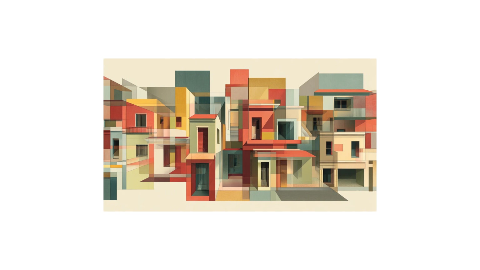
Designing the Post-Congestion City: A Human-Geography View Beyond Europe's Current Comfort Zone
Rush hour is not a law of nature. It is a spatial decision. A city chooses—street by street, rule by rule—who is allowed to move fast, who is allowed to stop, and who is forced to wait. Meridian City is a thought experiment that takes existing evidence seriously and refuses to stop where current politics usually flinch.

Key Insights
Essential takeaways from this chronicle
Rush hour is a spatial decision, not a law of nature—cities choose who moves fast, who stops, and who waits
Point 1 of 7Over 300 European cities use congestion charges, LEZs, or superblocks: London's charge cut traffic 21%, Stockholm's tax 20%, Barcelona's superblocks reduced NO₂ by 25%
Point 2 of 7Evidence shows these work, but most cities layer interventions onto car-centric networks—Meridian City asks: how far could we go with an integrated regime?
Point 3 of 7Cellular street structure (like LTNs/superblocks) + priority corridors for BRT + access pricing + parking reform = coherent post-congestion mobility regime
Point 4 of 7Equity is structural, not symbolic: outer-district transit first, income-related discounts, revenue to polluted neighborhoods, coordination with anti-displacement policy
Point 5 of 7Physical lock-in is the most powerful ally: once streets are replanted and reallocated, reversal costs are prohibitive—interventions become the new 'natural' state
Point 6 of 7Not a city without cars, but a city that admits not all trips are equal and streets can be reprogrammed when private convenience harms public well-being
Point 7 of 7
Designing the Post-Congestion City: A Human-Geography View Beyond Europe's Current Comfort Zone
A city chooses—street by street, rule by rule—who is allowed to move fast, who is allowed to stop, who is allowed to stay, and who is forced to wait with the engine running. We are used to treating those choices as technical details. They are not. They are the visible edge of a mobility regime: a bundle of infrastructures, incentives, habits and stories about what a city is for.
Over three hundred European cities now have congestion charges, low-emission zones, "superblocks", low-traffic neighbourhoods or some other attempt to tame the private car. Evaluations show that these measures work: traffic falls, bus speeds improve, pollution drops. London's congestion charge cut traffic inside the zone by about 21 % in its early years and contributed to significant reductions in key pollutants. Stockholm's congestion tax has delivered a 20 % traffic reduction that has proved stable over time and cut CO₂ emissions in the region by around 2–3 %. Barcelona's superblocks have reduced nitrogen dioxide by roughly 25 % inside the pedestrianised area and significantly cut noise. Low-traffic neighbourhoods in London have shifted trips towards walking and cycling without displacing traffic proportionately onto boundary roads, and they are not disproportionately concentrated in rich areas.
So the question is no longer, "Can we do anything?" We can. The question, if we take cities seriously as designed environments, is: How far could a city go if it treated this evidence as a foundation, not a ceiling?
This essay answers from the vantage point of human geography. It sketches what a "post-congestion" city might look like if it pushed beyond the current European mainstream while staying anchored in what we already know from research and practice. It does not offer utopia. It offers a coherent regime that is more radical than most politics, but less radical than the physics of climate and air pollution will ultimately demand.
I will call this city Meridian City: an archetype, not a dot on the map.
⸻
1. From traffic management to mobility regimes
For most of the twentieth century, cities approached movement as a capacity problem. The task of planners and engineers was to keep vehicles flowing. Streets were classified into local, collector, arterial and highway; models translated people into peak-hour car units; "level of service" was defined almost entirely from the car's point of view.
In that worldview, congestion is a kind of technical failure, to be solved with more asphalt, more lanes, more flyovers, or—later—better signal timing and "intelligent transport systems".
Human geography offers a different lens. Instead of asking "how do we move vehicles?", it asks:
- Who and what are we moving?
- Between which parts of the urban fabric?
- Under what rules and power relations?
- With what consequences for health, inequality and the environment?
Once you adopt that lens, the unit of analysis stops being a single scheme—a charging cordon here, a bus lane there—and becomes the mobility regime: the relatively stable pattern of infrastructures, regulations and expectations that defines how a city moves.
The European Commission's large comparative study of Urban Vehicle Access Regulations (UVARs) makes this shift explicit. It shows that cities now deploy a whole typology of restrictions: pedestrian zones, environmental zones, congestion pricing, low-emission zones, time-dependent access rules, weight and size limits. Yet in most cities these are still layered onto a street network whose basic grammar remains car-centred.
Similarly, research on low-traffic neighbourhoods (LTNs) in London treats them as more than local traffic calming. They are framed as structural changes in how streets function across a network, not just on one block. The same is true for Barcelona's superblocks, which deliberately reorganise the grid so that through-traffic is forced onto periphery streets, freeing interior streets for walking, cycling and local life.
These developments hint at a shift from managing congestion within a car regime towards deliberately constructing a different regime. Meridian City is what happens if you take that shift to its logical conclusion.
⸻
2. What we already know: the evidence base
Before drawing any new map, it helps to see how far the existing one reaches. Four strands of research are particularly relevant: congestion charging and UVARs; priority for public transport; parking policy; and urban freight.
2.1 Congestion charging and UVARs
The strongest body of empirical work concerns pricing and access control.
London's congestion charge, introduced in 2003, has been evaluated repeatedly. Early assessments found a ~21 % reduction in traffic entering the zone and corresponding reductions in NOx, PM and CO₂ emissions. The scheme also boosted bus travel sharply, by making bus speeds and reliability more attractive. Stockholm's congestion tax, trialled in 2006 and made permanent in 2007, cut traffic across the cordon by around 20 %. Crucially, this reduction persisted—and even grew slightly—over the next five years even as the city grew, suggesting that such charges can have durable effects rather than being neutralised by induced demand.
UVARs go beyond pricing. The Commission's 2017 synthesis shows a rapid expansion of low-emission zones, environmental zones and access-for-residents-only schemes in European cities. More recent follow-up through projects such as UVARBox and UVARExchange has systematised how these schemes are classified and communicated, from simple pedestrian zones to complex low-emission and climate zones. Evidence on their effects is uneven, but London's Ultra Low Emission Zone (ULEZ) provides one striking example: after its 2023 expansion, nitrogen dioxide concentrations fell by an estimated 27 % in the covered area.
The lesson is straightforward: where cities take away the automatic right to drive any vehicle, anywhere, any time—and back that with penalties—behaviour changes at scale. The harder questions are about design (who is exempt, which areas, which times) and distribution (who pays, who benefits).
2.2 Priority for public transport
If a city wants to move many people with few vehicles and less space, it has no real alternative to high-capacity public transport.
A long line of research on Bus Rapid Transit (BRT) shows that when buses are given their own right-of-way and supported with modern operations, the results can rival rail systems at far lower capital cost. In Bogotá, the TransMilenio BRT system cut average travel times by roughly 32 % on served corridors and reduced emissions by around 40 % through scrapping old buses and running high-capacity articulated vehicles on cleaner fuels. Network-level modelling suggests that a good BRT investment can reduce congestion by around 9 % and raise average speeds by nearly a quarter.
At a more granular level, transit signal priority (TSP)—letting a late bus hold a green signal or shorten a red—has been shown to improve reliability and reduce waiting times measurably, with limited negative impact on general traffic when designed with care.
The implication is important: giving public transport real, physical and temporal priority is not a symbolic gesture. It is a proven method to move more people, more reliably, through the same streets.
2.3 Parking as a driver of demand
Congestion and car dependence are not just functions of road supply. They are functions of how easy and cheap it is to end a car trip.
Donald Shoup's work on parking is blunt: "free" or underpriced parking is not free at all; it embeds the cost of car storage into everything else—higher rents, lower density, more driving. Minimum parking requirements in zoning codes have, over decades, hard-wired car dependence into land use. Market-priced on-street parking, dynamically adjusted to keep 1–2 spaces free per block, is one of the simplest levers for reducing "cruising" traffic and nudging mode choice.
Parking policy research rarely uses the language of human geography, but its conclusion is spatial: parking is the interface between the private vehicle and the shared city. Change that interface and you change the regime.
2.4 Urban freight and consolidation
The circulation of goods is often the blind spot in mobility debates. Yet urban freight accounts for a disproportionate share of noise, local pollution and kerbside conflict.
Studies of urban consolidation centres (UCCs) show mixed but instructive results. A classic review by Browne and colleagues documents how a handful of north European cities used UCCs to reduce heavy-goods movements in their cores, sometimes by more than 50 %, at the cost of somewhat higher logistics complexity. More recent meta-analyses point out that UCCs can deliver local environmental benefits, but impacts depend strongly on governance, pricing and integration with wider logistics systems.
Meanwhile, the EU's guidance on Sustainable Urban Logistics Plans emphasises micro-hubs and parcel lockers within a 15-minute walk of most residents, supplied from consolidation centres and served by low- or zero-emission vehicles.
In other words: freight can be reorganised. It is not condemned to be a swarm of large diesel vans improvising kerb space.
2.5 Health and co-benefits
Finally, there is the public-health literature. Modelling work in The Lancet has shown that strategies combining mode shift to walking and cycling with cleaner vehicles could cut urban CO₂ emissions sharply while reducing premature deaths from air pollution, inactivity and traffic injuries. Evaluations of superblocks and LTNs suggest not only lower pollution and noise, but more social interaction and perceived safety.
The conclusion from this wide but converging evidence is that cities have many pieces of a better regime already on the table. What they mostly lack is an integrated design that combines them into something more than the sum of their parts.
⸻
3. Meridian City as a research-based scenario
Enter Meridian City. Not a fantasy metropolis, just a composite of the kinds of mid-sized cities that stretch from the Baltic to the Great Lakes and the southern cone of the Americas.
Meridian sets itself a sharper goal than most:
- reduce vehicle-kilometres by 30 % in fifteen years
- keep the share of trips by private car below 20 %
- guarantee a maximum delay threshold in peak hours for public transport and designated "essential freight" routes
It does not get there through a single "silver bullet" technology. Instead, it assembles the existing evidence into a deliberate regime.
3.1 A city of cells, not shortcuts
First, Meridian adopts a cellular street structure.
Inspired by London's LTNs and Barcelona's superblocks, the city divides its inner and middle rings into neighbourhood cells. Within each cell, any address is reachable by motor vehicle, but no cell can be used as a through-route by general traffic. Physical filters, one-way loops and banned turns ensure that cut-through driving simply does not work.
Through-traffic is channelled onto a sparser mesh of primary corridors. This is not "traffic calming" as an afterthought; it is an explicit declaration that residential and local streets are for access and life, not for cross-city flows.
Geographically, the effect is twofold:
- inside cells, speeds drop and street life becomes more possible
- on primary corridors, congestion becomes more visible, which makes it easier—politically and technically—to justify further intervention
3.2 Priority corridors as mobility spine
On those primary corridors, Meridian stops pretending all vehicles are equal.
Public transport receives BRT-style treatment on the busiest radial routes: continuous, physically protected lanes where road width allows, enforced by cameras and design, not just paint. At intersections, buses and trams get transit signal priority calibrated to protect headways and reduce bunching, drawing directly on the reliability gains observed in Stockholm and elsewhere.
Modelling shows that such corridors can increase effective person-throughput dramatically compared to mixed-traffic lanes, while BRT case studies show travel-time reductions of 20–30 % and significant mode shifts away from private car.
For freight, Meridian designates a limited set of urban freight spines. Large trucks are confined to these and to the ring roads, serving a constellation of urban consolidation centres. From there, smaller electric vans and cargo bikes handle last-mile delivery into cells, using signed loading bays with time restrictions rather than improvising on pavements and bike lanes. This system mirrors the best-documented UCC schemes, but at metropolitan scale.
Private cars are still permitted on the corridors, but their status is explicit: they are the lowest-priority user.
3.3 Access and pricing as rationing tools
Meridian introduces a two-layered access system.
At the outer urban cordon, a time-differentiated congestion charge applies, structurally similar to London or Stockholm but tuned to guarantee a target volume, not just to raise revenue. Within the inner ring, additional UVARs apply: low-emission criteria, weight and size limits, and in the most sensitive zones, time-window restrictions on all but residents, emergency vehicles and certain categories of service traffic.
Crucially, Meridian treats access tokens as a scarce good. Households receive a limited annual allowance of peak-hour entries into the inner ring at a base price; beyond that, the marginal cost rises steeply. High-emission vehicles pay more; zero-emission vehicles pay less for pollution but not for space. Businesses can purchase additional allowances, but not without limit.
The point is not to perfect the pricing algorithm. It is to break the cultural assumption that the right to drive into the core at 8:30 on a Tuesday is inalienable.
3.4 Parking as structural reform
Alongside this, Meridian undertakes a slow but firm parking reform.
Over a 10–15-year horizon, on-street parking in the inner city is reduced by at least half, with clear intermediate milestones. Spaces are not simply moved underground; many are abolished. The reclaimed kerb space is reassigned to wider sidewalks, protected bike lanes, bus platforms, trees and logistics bays.
Where on-street parking remains, it is priced dynamically so that 10–20 % of spaces are free at any given time, minimising cruising. This follows Shoup's prescription directly. New developments face strict maximums, not minimums, for off-street parking, especially near strong transit. Residential parking is unbundled from rent and property price so that households see its cost.
In mapping terms, the city gradually erases one layer of "car habitat" from its core and redraws it as habitat for other modes and activities.
⸻
4. Equity and the politics of space
A regime like Meridian's will not be judged only by its congestion metrics. It will be judged by who it serves and who it hurts.
Empirical work on LTNs in London shows that, at least there, schemes were more likely to be implemented in areas with below-average car ownership and did not systematically favour the wealthy. Evaluations of superblocks highlight gains in walkability and quality of life, but also concerns about boundary-road traffic and the risk of "green gentrification". Industry groups warn that UVARs, if badly designed, can damage small businesses and households who cannot easily afford vehicle upgrades.
Meridian therefore builds distributional considerations into its design, not as afterthought but as constraints:
- Outer-district transit improvements—frequent, reliable corridors connecting housing estates to job centres—are implemented in the early phases, before the toughest cordon charges ramp up.
- Income-related discounts or caps are applied to congestion charges and access fees, modelled on existing social fares for public transport, to protect low-income drivers with genuine necessity.
- A portion of revenue is earmarked for targeted street improvements in historically polluted and neglected neighbourhoods, echoing calls in environmental justice literature to link mobility and health equity.
There is also a temporal dimension to equity. Those who bear the disruption of construction and the pain of transition are not always those who will reap the long-term benefits, especially if rising amenity values later push them out. Meridian cannot solve displacement through mobility policy alone, but it can coordinate: anti-displacement measures, inclusionary zoning and social housing in improved areas must accompany the redesign of streets if benefits are to be shared.
From a human-geography standpoint, the key is transparency. A regime that openly states whose movement is being prioritised for which reasons—health, access to work, care responsibilities—can at least be debated honestly. One that hides behind neutral language of "flow" and "efficiency" cannot.
⸻
5. Time, lock-in and irreversibility
Transport interventions operate on awkward time scales.
The pain is immediate. Remove parking, and affected drivers complain tomorrow. Filter a street, and the first week's confusion generates headlines. Implement a congestion charge, and the first month's payments sting.
The gains are gradual and diffuse. Fewer children hit by cars rarely make the news; parents simply walk with a little less tightness in their shoulders. Reduced nitrogen dioxide shows up in epidemiological data, not in anecdotes. Retail streets that shift from "drive-through" to "linger" economies take years to stabilise.
Evaluations of Stockholm's congestion tax are instructive: initial public opinion was hostile, but once the system had run and demonstrable benefits emerged, support grew enough that a referendum endorsed its continuation. Similar patterns appear in London's ULEZ expansion: fierce protests at first, then quieter acceptance as air quality data accumulate.
Meridian's designers understand that their most powerful ally is physical lock-in. Once a superblock is planted with trees and benches, once a former four-lane road has been reallocated to two general lanes plus BRT and protected cycling, the cost—financial and political—of reverting is high. Over a decade or two, these changes become part of the city's "natural" state in the public mind.
This is not manipulation. It is simply the flip side of how the car regime itself became entrenched: through accumulated, concrete decisions that were later forgotten as choices.
⸻
6. Beyond the current European frontier
Does Meridian really go beyond what cities are already doing?
Individually, no element is unprecedented. BRT exists. Superblocks exist. LTNs exist. UVARs exist. Paid parking exists. UCCs exist. Healthy-streets frameworks that count kilometres walked and deaths avoided exist.
What is rare—and, for now, largely theoretical—is putting these elements together at city scale with a clear hierarchy of goals:
- Protect public transport reliability.
- Protect essential goods and service movement.
- Reduce private car dependence structurally, not just at the margins.
- Redistribute street space toward healthier, safer uses.
The typical "good" European city of today has pockets of this regime: a congestion charge here, an LTN there, a car-free square, a pilot consolidation centre. What it often lacks is the nerve to make these pockets the rule rather than the exception.
Meridian City is simply a thought experiment that takes the existing evidence seriously and refuses to stop where current politics usually flinch.
From a human-geography standpoint, its most important contribution is conceptual. It invites us to think of traffic not as a problem of flow to be optimised, but as one expression of how a city allocates time, risk and access among its inhabitants. In that framing, congestion is not just lost minutes. It is a symptom of a regime that insists on offering every individual the same claim on a scarce resource—street space at peak time—while pretending that this is compatible with collective well-being.
It is not.
A post-congestion city is not a city without cars. It is a city that admits, frankly, that not all trips are equal, that space and time can be rationed with justice in mind, and that streets can be reprogrammed, like any other shared infrastructure, when the balance between private convenience and public harm has tipped too far.
⸻
References
Aldred, R., Verlinghieri, E., Sharkey, M., Itova, I., & Goodman, A. (2021). Equity in new active travel infrastructure: A spatial analysis of London's new Low Traffic Neighbourhoods. Journal of Transport Geography, 96, 103–194.
Anas, A. (2021). Bus Rapid Transit versus road expansion to alleviate congestion. Case Studies on Transport Policy, 9(4), 1641–1651.
Anderson, P., et al. (2020). Effect of transit signal priority on bus service reliability. Accident Analysis & Prevention, 135, 105350.
Börjesson, M., & Kristoffersson, I. (2012). The Stockholm congestion charges – five years on. Transport Policy, 20, 1–12.
Börjesson, M., et al. (2018). Long-Term Effects of the Swedish Congestion Charges. OECD/ITF Discussion Paper.
Browne, M., et al. (2005). Urban Freight Consolidation Centres Final Report. University of Westminster.
European Commission (2017). Study on Urban Vehicle Access Regulations (UVARs) – Final Report. Directorate-General for Mobility and Transport.
European Commission (2024). Sustainable Urban Logistics Plans (SULPs) – Recommendations and Guidelines.
Gillström, H., et al. (2024). Assessing the benefits of urban consolidation centres. Transport Reviews.
Green, C. P., et al. (2020). Did the London congestion charge reduce pollution? Regional Science and Urban Economics, 84, 103573.
Nieuwenhuijsen, M. J., et al. (2024). The Superblock model: A review of an innovative urban intervention to promote health and environmental sustainability. Environment International.
Pérez, K., et al. (2025). Environmental and health effects of the Barcelona superblocks. BMC Public Health.
Ricci, A., et al. (2017). Urban Vehicle Access Regulations in Europe – Final Report. European Commission.
Shoup, D. (2005). The High Cost of Free Parking. Chicago: Planners Press.
Transport for London (TfL). (various years). Congestion Charging Impacts Monitoring Reports and ULEZ evaluation.
Woodcock, J., Edwards, P., Tonne, C., et al. (2009). Public health benefits of strategies to reduce greenhouse-gas emissions: urban land transport. The Lancet, 374(9705), 1930–1943.
World Bank. (2010). TransMilenio Bus Rapid Transit (BRT) Bogotá, Colombia. ESMAP Report.
Continue Reading

Why New Apartments Feel Smaller Than Their Plans
New flats are warmer, safer and more efficient than old ones — and often feel worse to live in. Windows, ceilings and corridors reveal the loss of spatial generosity after Art Nouveau and Art Deco, and why compliant housing can still be uncivilized.

The Right Height: How Mid-Rise Cities Beat Both Sprawl and Towers
Five to eight storeys is the sweet spot for sustainable cities. Here's how Vienna, Vancouver, and Melbourne can build walkable, affordable, climate-conscious neighbourhoods without choosing between sprawl and glass towers.
When the Minimum Standard Becomes the Home
Light, ceiling height, corridors, floor area — and the quiet dismantling of residential quality. When regulation becomes the ceiling instead of the floor, cities produce dwellings designed for minimum life.