The City After the Car: New York, Los Angeles, Paris, Barcelona and Utrecht
Once a city accepts that traffic responds to price and design, a harder question follows: what to do with the land and street space it no longer needs for cars. Five cities are answering it in five different ways.

Key Insights
Essential takeaways from this chronicle
In the first year of New York's congestion pricing, about 27 million fewer vehicles entered Manhattan below 60th Street, an average fall of 11 percent. An NBER study found that speeds also rose on roads outside the charging zone.
Office of the Governor of New York, first-anniversary results of congestion pricing (January 2026)Cook et al., The Network-Wide Effects of Congestion Pricing: Evidence from New York City, NBER Working Paper 33584Point 1 of 5California handed Pasadena about 50 acres of the unbuilt 710 freeway's trench in 2022. In April 2026 the City Council approved a vision plan for the land, with a goal of at least 1,800 homes, and acknowledged the harm done to the people forced to leave.
City of Pasadena, 710 Revisioning ProjectStreetsblog California, Pasadena adopts most of the 710 Stub vision plan (April 2026)Point 2 of 5Paris closed 3.3 kilometers of the Right Bank expressway to cars in 2016. A court annulled the first decision in 2018; in 2019 the administrative appeal court upheld the order that replaced it, citing protection of the UNESCO-listed riverbanks.
Point 3 of 5In Barcelona's Sant Antoni superblock, nitrogen dioxide fell 25 percent and PM10 17 percent at a measuring point on a pedestrianized street. In the Horta superblock the same evaluation found no significant overall change in air pollution.
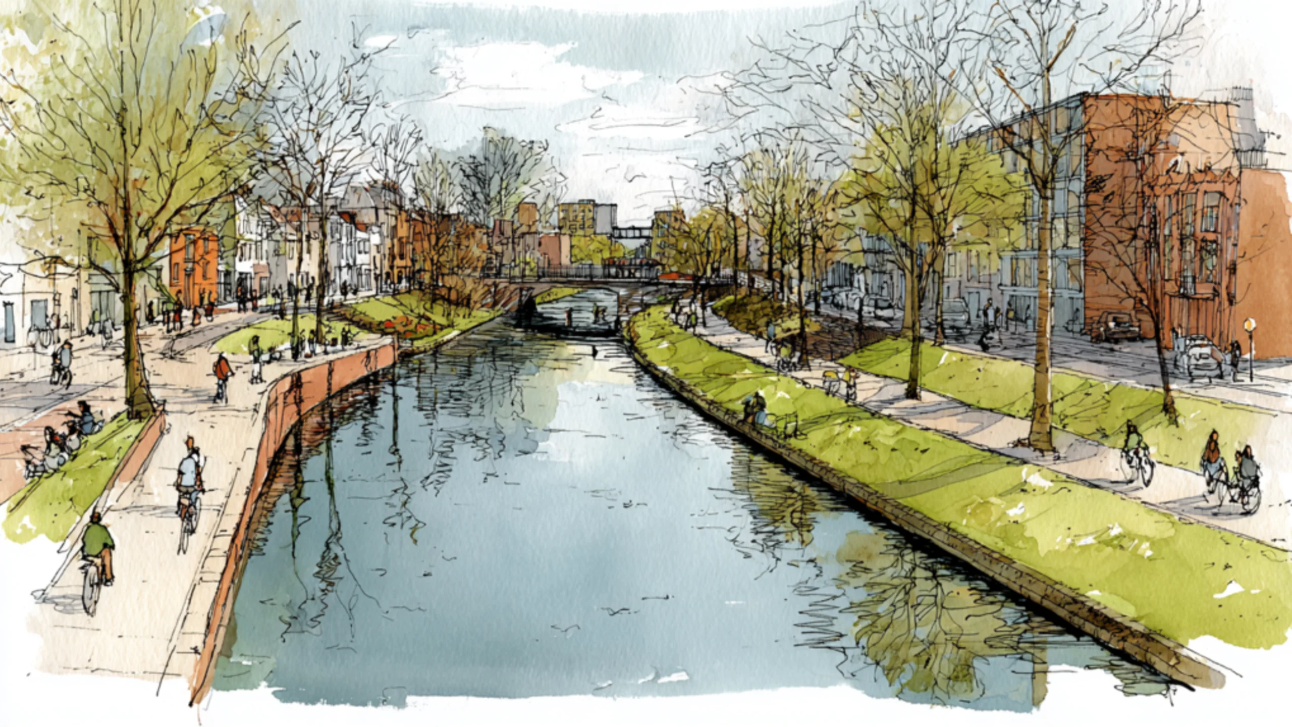
Pérez et al., Environmental and health effects of the Barcelona superblocks, BMC Public Health 25:634 (2025)European Court of Auditors, Special Report 02/2025, Urban pollution in the EUPoint 4 of 5Utrecht began filling in part of its Catharijnesingel canal in 1969 to build a motor road. After a 2002 referendum on the station-area plan, the city restored the water, and the ring of canals around the old center reopened on 12 September 2020.
Gemeente Utrecht, De singel is rond (September 2020)DUIC, Megaproject komt ten einde (September 2020)Point 5 of 5
Cities give an enormous share of their land to driving. Roads, intersections, ramps, garages and loading zones occupy some of the most valuable ground people have ever assembled. They divide neighborhoods, cut off rivers, take over waterfronts and add noise and danger to ordinary journeys.
Much of that infrastructure rests on an assumption that once seemed sensible: as cities grew richer, more people would drive, so roads had to become wider, faster and more numerous.
The evidence now runs the other way. Roads help produce the traffic they carry. Make driving easier and more journeys become worth making by car. Make the alternatives attractive and some of those journeys leave the road network while the trips themselves continue on foot, by bicycle or by train. Our earlier essay, When the Road Went Away, followed that evidence through San Francisco's Embarcadero, Seoul's Cheonggyecheon and Oslo's Bryn tunnel.
Those cases answered whether a city can survive losing a major road. The question that follows is harder: what should a city do with the land and street space it no longer has to hand to traffic?
Five cities give unusually revealing answers. New York has shown that pricing can cut traffic, and still carries the scars of mid-century expressway building. Los Angeles has land acquired for a freeway that was never finished. Paris is turning car streets and riverbanks into public space. Barcelona is reorganizing whole street networks around its blocks. And Utrecht, a smaller Dutch city, removed a major road and put back the canal it had replaced.
Together they point to a city in which driving remains possible and stops being the organizing principle of daily life.
1. New York: the city that can afford to take space back
Most New Yorkers do not need a car to get through the day. The subway, buses, commuter rail, ferries and dense neighborhoods give the city an alternative transport system on a scale found nowhere else in the United States. Large parts of its public space are still organized around moving vehicles.
Walk along a big Manhattan avenue and the imbalance is visible. Thousands of pedestrians squeeze along the sidewalks beside lanes that carry far fewer people. A delivery truck takes the curb, a bus waits behind a taxi, a cyclist edges past turning traffic. The sidewalk carries more people than the roadway, and the roadway still gets most of the width.
New York's opportunity is to bring the use of its street space into line with how New Yorkers travel.
Congestion pricing changed the arithmetic
On January 5, 2025, New York began charging most vehicles to enter Manhattan south of 60th Street. Opponents warned of economic damage, displaced traffic and unfair costs. Supporters expected fewer vehicles, faster journeys and new money for transit.
A year later, the governor's office reported MTA figures showing about 27 million fewer vehicles entering the zone in the first year, roughly 73,000 fewer a day and an average fall of 11 percent. Morning rush-hour speeds on the crossings into and out of the zone rose an average of 23 percent, with the Holland Tunnel 51 percent faster, and weekday speeds inside the zone rose 4 percent.
An independent study reached a wider conclusion. Cody Cook, Shoshana Vasserman, Hunt Allcott and colleagues estimated that speeds within the charging zone rose about 11 percent and that speeds also improved on many roads outside it, where nobody paid a charge. A small reduction in traffic produced gains across a much larger network. Their working paper, first issued by the National Bureau of Economic Research in March 2025 and revised in August 2026, found little effect on consumer spending or foot traffic. The commercial collapse that opponents predicted did not show up in the data.
The air-quality evidence is more mixed. In August 2026 the city's Health Department reported that air quality in and around the zone had remained stable or improved slightly, with no increase in pollution attributable to the toll. A study by Polina Goldberg, Daniel Westervelt and colleagues, published in October 2026, went further for fine particles: comparing the first year with 2022 to 2024, it attributed a fall of about 1.4 micrograms per cubic meter of PM2.5 at monitors inside the zone to the policy. Nitrogen dioxide fell by more than 20 percent across the metropolitan area in satellite data, but too little of that could be traced to the charge to credit it.
The evidence supports a firm conclusion about traffic and a cautious one about pollution. The larger result is political: New York has shown that demand for road space can be managed, after decades of trying to accommodate it.
The Cross Bronx: repairing a wound
The Cross Bronx Expressway is one of the most damaging pieces of urban planning in the United States. Robert Moses drove it through established neighborhoods in the decades after the Second World War. It split communities, displaced residents and put heavy traffic beside homes, schools and local streets. The people who live closest to it have carried most of the noise, pollution and difficult crossings.
In March 2025 the city's Department of Transportation published the final report of Reimagine the Cross Bronx. It proposes safer crossings, new public spaces, better walking and cycling routes and redesigned ramps. Among its long-term concepts are caps over parts of the highway: one would reconnect Walter Gladwin Park and Crotona Park, others would cover the road between University and Walton Avenues and near Hugh J. Grant Circle. Another proposal would bring life to the spaces beneath the elevated section between Webster and Third Avenues. The caps need further study, and their funding has not been identified.
The expressway carries freight as well as commuters, and diverting heavy trucks onto residential streets would make the Bronx worse.
A sensible plan would separate the regional movements that need the corridor from journeys that better transit could absorb. Selected sections could be capped, local crossings rebuilt, noise barriers and ventilation improved for nearby homes, and parallel streets made safe to walk. The test of success is whether the neighborhoods on either side work again as one piece of city.
Brooklyn's harder decision
The Brooklyn-Queens Expressway poses a more immediate engineering problem. In August 2026 the city announced a rehabilitation of its deteriorating city-owned section, about a mile and a half from Atlantic Avenue to Sands Street, including the triple cantilever beneath the Brooklyn Heights Promenade. The Department of Transportation puts the cost at $3.5 billion to $4 billion. The road carries about 130,000 vehicles a day, 13,000 of them trucks.
The program keeps the highway and routes traffic onto temporary bypasses during construction. It repairs the road and leaves its effect on the neighborhood in place.
Keeping an aging structure safe may be necessary in the near term, given the freight it carries and the disruption a sudden closure would cause. Extending its life still leaves its urban costs unaddressed.
New York could use the years of rehabilitation to prepare an independently evaluated long-term alternative: better freight logistics, stronger transit, redesigned ramps, safer waterfront access and, if demand and network studies support it, a smaller road. A city that spends billions preserving old infrastructure should ask whether the next generation will need all of it.
New York's central opportunity: turn lower car demand into permanent gains in public space, bus reliability and reconnected neighborhoods, above all in the Bronx and Brooklyn.
2. Los Angeles: reclaiming the land of a freeway that never arrived
Los Angeles is often treated as the inevitable capital of the car. As our earlier essay on the 1930 Olmsted-Bartholomew parks plan showed, the city once had an extensive electric railway network and a regional vision for parks and river corridors, long before freeways came to define it.
Much of that potential was lost. Some striking opportunities remain, and the most promising involves land acquired for a freeway that was never completed.
Pasadena and the unfinished 710
The planned northern extension of State Route 710 hung over Pasadena for half a century. Caltrans bought and cleared property along the route and left a sunken freeway stub behind. The extension was cancelled in 2017.
In 2022 the state relinquished about 50 acres of the stub to the city. The California Transportation Commission approved the transfer on June 29, 2022, and title passed to the city that August.
On April 13, 2026, the City Council unanimously approved most of Reconnecting Pasadena, a vision plan for the site. It calls for reconnecting the street grid, a walkable mixed-use district, better walking and cycling routes, public space and a minimum of 1,800 homes. The city's own account says the stub displaced thousands of residents when their homes were destroyed, and that most of those homes were owned or rented by low-income and minority residents. The council formally acknowledged the harm done to the residents, businesses and institutions forced to leave, and sent the plan's detailed restorative-justice framework back for further work.
A corridor reserved to move vehicles through the city could become a district where people live in it. Ordinary streets could replace the ramps and retaining walls, apartments, trees, shops and squares could fill the trench, and the street grid could join the east and west sides of the city again.
The project repairs a historical decision as well as filling vacant land, and it carries its own danger. Former freeway land is valuable. A redevelopment built around expensive housing and prestige retail could produce an attractive district that excludes the descendants of the people who lost their homes to the original project.
That makes the unfinished restorative-justice framework the decisive part of the plan. Affordable housing, restorative justice and long-term public control of key spaces need to be written into how the project is governed. Left to later negotiation with developers, they tend to shrink. Delivery, financing and institutional responsibility are the harder chapters still to come.
Freeway caps
Los Angeles also has places where a sunken freeway could be covered. A cap is a structural deck over a highway that carries parks, paths and sometimes buildings, reconnecting the neighborhoods on either side.
One proposal would reunite Belvedere Park in East Los Angeles, which the Pomona Freeway cut in two. The Federal Highway Administration describes it as an early-stage proposal that has been neither approved nor funded.
Where a highway runs below street level, a cap can recover public space without first removing the regional road. It can restore walking routes, tree cover, recreation and local access. Caps are also expensive, constrained by engineering and ventilation, and they leave traffic emissions at their source. A city can spend large sums hiding a freeway when cutting traffic, repairing surface streets or investing in transit would buy more per dollar.
A good strategy would start with short caps near schools, hospitals, parks and the communities the highway divides most sharply, and leave the most photogenic sites for later.
A larger opportunity than the freeway
A better Los Angeles would combine reclaimed corridors with growth around transit stations, bus priority and a wider regional cycling network. It would treat the Los Angeles River paths as transport routes as well as places for recreation, link parks to neighborhoods and stations, and shade walking routes against summer heat that is growing more severe.
Most of all, it would stop treating every regional trip as a reason for more road capacity. Los Angeles will remain geographically vast. It can still become a set of walkable districts joined by high-capacity transit, each with everyday services within reach without a car.
Los Angeles's central opportunity: turn abandoned highway land and selected road barriers into complete neighborhoods, and build metropolitan growth on transit, shade and local access.
3. Paris: the river belongs to the city again
Paris shows what happens when a city stops using its most beautiful feature as a through route.
For decades the Voie Georges-Pompidou on the Right Bank of the Seine gave drivers a fast passage through the center and put moving traffic between the city and its river. In 2016 the city closed 3.3 kilometers of it, between the Tuileries tunnel and the Henri-IV tunnel, to ordinary traffic and turned it into a promenade.
The closure went to court. In February 2018 the administrative tribunal annulled the 2016 decision because its impact study was inadequate. The mayor issued a new order the following month. In June 2019 the Paris administrative appeal court upheld that order. It found the closure justified by the protection of the riverbanks, part of a UNESCO World Heritage site, and not disproportionate: the upper quays stayed open, and crossing Paris had become slower without becoming impossible.
A modest loss of convenience on some journeys can be justified by a large gain in public life.
A network of reclaimed streets
Paris has kept reallocating street space. On Rue de Rivoli, long one of the city's busiest traffic arteries, the city's counters recorded 97,941 cyclists in the week of June 24, 2024.
The city counted 1,607 kilometers of cycle routes in 2025, a broad definition that includes shared and two-way facilities. On the stretch of network it has monitored since 2020, cycling volume was 47 percent higher than in that first year.
When cycling becomes safe and direct enough, people reconsider which journeys need a car. Paris has also removed surface parking and planted local streets. On March 23, 2025, residents voted in a city consultation on greening and pedestrianizing 500 more streets. The proposal won 65.96 percent of the votes, on a turnout of 4.06 percent: a clear mandate from the people who voted, and a small share of the electorate.
The program still marks a strategic shift. Paris is reorganizing its local street network as a whole, where each street closure used to be fought as a separate battle.
The next change belongs outside the postcard
Celebrations of Parisian urbanism tend to stay in the central arrondissements. The Boulevard Périphérique remains a wide physical and social barrier between Paris and its neighbors, and the homes and schools along it live with its traffic.
The next round of improvements belongs on that edge: safer crossings over the ring road, bus and tram priority, less road traffic beside homes and schools, and green routes that carry on into the suburbs past the city limit.
Paris also needs to keep pedestrianized streets open to people who want to sit without buying anything, and resist letting each one fill with café terraces.
The real achievement would be to give the everyday comfort of central Paris to people who now experience the city mainly as a distant place of work.
Paris's central opportunity: turn the central-city transition into a metropolitan project that reconnects the suburbs, cuts exposure to pollution and treats streets as public space.
4. Barcelona: the street as an extension of the home
Barcelona starts with a geographical gift: an unusually coherent grid. Ildefons Cerdà drew up his plan for the Eixample in 1859 as an answer to industrial crowding, disease and poor living conditions. Its chamfered corners, cut at 45 degrees, and wide streets gave the new district a flexible structure.
The twentieth century filled much of that structure with vehicles. One of Europe's most celebrated pieces of urban design became an efficient machine for distributing traffic.
Barcelona's superilles, or superblocks, try to reverse that order. Through traffic is kept out of selected local streets, and pedestrians, cyclists, residents and local activities get priority. Streets gain trees, benches, planting and places to gather. The largest changes have come in Poblenou, Sant Antoni and the Eixample, where Consell de Cent was converted into a green axis in 2023.
What the evidence says
A 2025 study in BMC Public Health, by Katherine Pérez, Laia Palència, Carme Borrell and colleagues, evaluated three early superblocks, in Poblenou, Sant Antoni and Horta, through environmental measurements, surveys, observation and interviews.
Residents and workers reported more calm, better sleep, greater well-being and more social contact. The air-quality results varied by place. In Sant Antoni, nitrogen dioxide fell 25 percent and PM10 17 percent at a measuring point on a pedestrianized street. In Horta the study found no significant overall change, with indicative reductions in some parts. The European Court of Auditors, reviewing urban pollution across the EU in 2025, cited the same figures and noted that in Horta the effect was marginal or pollution rose.
Urban change has to be judged by measurement. Removing traffic from one street does not guarantee better conditions on the next, and the auditors noted that streets around such projects can end up with worse air and noise.
A street network has to be managed as a system. Barcelona's opportunity is a coherent network that reduces total traffic, keeps access for essential deliveries and avoids pushing traffic onto neighboring residential streets.
The missing dimension: housing and use
Barcelona also shows a difficult social consequence of better public space. When a noisy street becomes attractive, the apartments beside it become more desirable. Rents can rise, and everyday shops can give way to cafés, restaurants and businesses aimed at visitors.
The auditors' report noted that in one superblock commercial activity rose 33 percent after traffic was restricted, and that bars and restaurants became new sources of noise. A 2026 study in Habitat International by María Gabriela Navas-Perrone and Javier Borge-Holthoefer, an ethnography of Consell de Cent, found that administrative and land-use rules limited the green axis's ecological ambitions, and that pedestrianization brought commercial uses and movement patterns nobody had planned for.
The lesson is uncomfortable: a greener street can become less socially accessible.
Barcelona therefore needs to tie public-space reform to housing policy and commercial regulation, so that the benefits of a quiet, shaded street go to the people who already live on it and do not become a mechanism for replacing them.
The block interiors of the Eixample offer another opportunity. The district counts 45 courtyards recovered as public space, with more planned, and many others are still occupied by buildings or hard surfaces. Opening more of them would bring shade, cooling, play space and quieter outdoor life close to people's homes, which matters more as summers get hotter.
The strongest version of Barcelona would join green streets, restored courtyards, transit and low-carbon housing into a single neighborhood system.
Barcelona's central opportunity: make the whole block, carriageway and courtyard together, a unit of urban well-being, with greenery, affordable housing, mobility and social life designed as one.
5. Utrecht: the city that put the water back
The most striking example in this comparison comes from a city far smaller than New York, Los Angeles or Paris.
In the twentieth century Utrecht followed the same logic as many European and American cities: growing car traffic needed more road capacity. The Catharijnesingel was part of the ring of canals around the medieval center. In 1969, to the dismay of many residents, the city began filling in a stretch of it to make way for the Catharijnebaan, a motor road beside the new Hoog Catharijne shopping and transport complex.
Utrecht eventually reversed that decision. In a 2002 consultative referendum on the future of the station area, nearly 60 percent of voters chose the plan for a more spacious city center. Years of planning and construction followed. On September 12, 2020, the city officially reopened the restored canal, closing the ring of water around the old city again. The local news site DUIC called it the undoing of a historic mistake.
A corridor once dominated by multi-lane road became water, trees, footpaths, cycle routes and public space. In Utrecht the result already looks natural: the water, trees, bridges and paths seem to belong there, and the road is what is hard to picture.
What the city restored was its relationship with the water, along with the canal itself.
Cycling as a complete system
A working bicycle city designs the whole journey, including what happens at the destination.
The bicycle parking garage under Stationsplein, fully opened in August 2019, holds about 12,500 bicycles. It is built into Utrecht Centraal station, with a cycle route running through it, electronic signs that show free spaces, a repair point and 1,000 rental bicycles. The city, the rail infrastructure manager ProRail and the national railway NS built and run it together. The first 24 hours of parking are free.
That design changes the geography of ordinary life. A person can cycle from home, park safely, board a train and reach another city without a private car at either end of the journey.
Such facilities draw less attention than an elevated metro or a monumental station hall. They remove the thousands of small inconveniences that otherwise make car ownership attractive.
A smaller city can make decisive changes without the capital that a New York expressway reconstruction demands. A canal restored, a station reorganized and a coherent cycle network can substantially change daily life.
What transfers from Utrecht
Utrecht benefits from a compact form, strong cycling institutions and an established national rail network. Los Angeles cannot import those conditions. It can borrow the habit of judging infrastructure over generations as well as by the travel time it saves next year.
A canal filled in for cars may later cost a great deal to restore. A street widened at the expense of homes and trees may become expensive to reclaim. A modest cycle route may reshape thousands of daily choices for decades.
The value of infrastructure includes the behavior it makes possible later.
Utrecht's central opportunity: keep tying housing growth to cycling, rail and green and blue public space, and show that smaller cities can lead through coherent, long-term decisions.
What the five cities teach
New York has exceptional rail density and the chance to repair highway damage. Los Angeles has land and unfinished infrastructure that could become neighborhoods. Paris has historic density and a public realm increasingly free of traffic. Barcelona has a block structure that supports coordinated change across whole neighborhoods. Utrecht shows how cycling and restored waterways can make a whole urban system more humane.
First, traffic responds to conditions: price, travel time, land use and the alternatives on offer. New York's congestion charge makes that especially clear.
Second, a city needs more from its streets than mobility. Street space can provide shade, quiet, recreation, biodiversity, social contact and better health. Appraisal methods already put money values on some of them, such as noise and the health gains from walking and cycling. Shade, biodiversity and social contact still need fuller treatment.
Third, transport and housing have to be planned together. A beautiful pedestrian street loses much of its social value if its residents are pushed out. A new transit line serves fewer people when the housing near its stations becomes unaffordable.
Fourth, reclaimed space has to serve ordinary life as well as visitors. A city needs deliveries, wheelchair access, tradespeople, schools, emergency services and affordable shops, and all of them remain when the private car loses priority.
Fifth, governance decides the outcome. Seoul paired its highway removal with a reorganization of the city's buses. New York tied its traffic charge to a funding stream for transit. Utrecht sustained decades of work to restore its canal. Each of these changes began with an institutional decision; the paving came afterward.
A practical program for the next generation of cities
Several measures need no monumental redevelopment.
Start with school streets: restrict through traffic near schools at arrival and departure times, improve crossings and give children a safer route to walk or cycle.
Turn selected residential street networks into low-traffic areas, with access kept for residents, essential services and deliveries. Measure what happens on the boundary roads before declaring success.
Give buses and trams priority at intersections and on congested corridors. A lane carrying a full bus serves many more people than one carrying single-occupant cars, so road capacity should be counted in people.
Recover surface parking, especially where many households already live without cars. Replace selected spaces with trees, cycle parking, loading bays, accessible seating and places to play.
Connect parks, courtyards and waterways into continuous walking and cycling routes. A connected green space becomes part of the city's transport and climate infrastructure.
Where major highway repair becomes unavoidable, require a serious assessment of alternatives. Ask whether every existing lane must be replaced, whether the road can be capped or narrowed, and whether transit or better freight logistics could serve some of its journeys.
Each of these measures leaves driving possible and removes its automatic first claim on the street.
Measuring a better city
Urban policy should be judged by what happens after the ribbon is cut.
| Measure | What it reveals |
|---|---|
| Car trips and vehicle-kilometers | Whether traffic falls overall or moves elsewhere |
| Door-to-door travel time | Whether people can reach work, schools and services reliably |
| Bus and tram journey-time reliability | Whether transit has gained real priority |
| Walking and cycling trips | Whether the alternatives are becoming practical |
| Noise and pollution exposure | Whether the benefits reach surrounding neighborhoods |
| Summer temperature and tree canopy | Whether reclaimed space improves climate resilience |
| Public space within a short walk | Whether improvements are shared fairly across the city |
| Housing and commercial rents | Whether residents can stay after the investment |
| Crashes and serious injuries | Whether streets are safer |
The most important measure may be the one least often collected: how much of ordinary life can people manage without planning around a car?
Can a child get to school alone? Can an older resident reach a park without crossing a dangerous arterial road? Can someone reach a supermarket, a library and a railway station on foot or by bicycle? Can a family live comfortably without a second car, or without one at all?
Those questions describe a city's freedom more accurately than the width of its roads.
The next urban luxury is ordinary life
The twentieth century made access to a car a symbol of prosperity. The ability to cross a metropolitan region quickly was sold as personal freedom, and for a time it delivered.
When millions of people have to use the same system for almost every journey, the promise turns inside out. Everyone gains a car and loses access to the city without one.
The next urban luxury may be something older and simpler: living an ordinary life without constant negotiation with traffic. A walk to the market. A shaded street in summer. A bicycle journey that takes no courage. A tram frequent enough that nobody checks the timetable. Children playing in a neighborhood square. A waterfront given back to the people who walk along it.
Many cities had these conditions once, gave them up, and are now rebuilding them at great expense. New York, Los Angeles, Paris, Barcelona and Utrecht are at different stages of that reconstruction. One is pricing traffic. One is reclaiming land from a freeway that was never built. One has returned its riverbank to pedestrians. One is rebuilding streets around neighborhoods. One has put water back where a road once ran.
Roads are tools, and cities need them. The mistake was letting one tool set the shape of everything else.
The city after the car will still have cars in it. It will have remembered what the city was for.
Selected evidence and further reading
- Office of the Governor of New York, Less Traffic, Better Transit: On Its First Anniversary, Governor Hochul Celebrates Transformational Success of Congestion Pricing (January 2026): first-year vehicle entries, the 11 percent fall and speed changes, from MTA data.
- Cody Cook, Aboudy Kreidieh, Shoshana Vasserman, Hunt Allcott, Neha Arora, Andrew Tomkins, Eray Turkel and Freek van Sambeek, The Network-Wide Effects of Congestion Pricing: Evidence from New York City, NBER Working Paper 33584 (2025, revised 2026): speed effects inside and outside the zone, spending and foot traffic. Not peer reviewed.
- NYC Department of Health and Mental Hygiene, first evaluation of congestion pricing and air quality (August 2026), and Polina M. Goldberg, Abhishek Anand, Daniel L. Goldberg and Daniel M. Westervelt, Attributing PM2.5 and NO2 Changes One Year after New York City's Congestion Pricing Policy, Environmental Science & Technology Letters (2026).
- NYC Department of Transportation, Reimagine the Cross Bronx final report (March 2025): caps, crossings and the space under the elevated section.
- NYC Department of Transportation, BQE Central, and NYC Mayor's Office, After Decades of Delay, Mayor Mamdani Moves to Fix the City-Owned Section of the Brooklyn-Queens Expressway (August 24, 2026): cost, extent and daily traffic.
- City of Pasadena, 710 Revisioning Project, the City Council agenda recap for April 13, 2026, and Streetsblog California, Pasadena Adopts Most of the 710 Stub Vision Plan (April 2026).
- Federal Highway Administration, Belvedere Park freeway cap project profile.
- Cour administrative d'appel de Paris, decision on the closure of the Right Bank quays to motor traffic (June 2019): the 2018 annulment, the replacement order and the court's reasoning.
- Ville de Paris, Près de 100 000 cyclistes sur la rue de Rivoli en une semaine, and Ville de Paris, Comment se sont déplacés les Parisiens en 2025: cycle counts, network length and the change since 2020.
- Ville de Paris, results of the March 2025 vote on 500 new green streets: share of votes and turnout.
- Katherine Pérez, Laia Palència, Carme Borrell and colleagues, Environmental and health effects of the Barcelona superblocks, BMC Public Health 25:634 (2025).
- European Court of Auditors, Urban pollution in the EU: Cities have cleaner air but are still too noisy, Special Report 02/2025: Barcelona superblocks, commercial activity and noise.
- María Gabriela Navas-Perrone and Javier Borge-Holthoefer, Limits to sustainability in pedestrianized public spaces: Administrative constraints and unintended uses in Barcelona's green axes, Habitat International 175 (2026).
- Ajuntament de Barcelona, Districte de l'Eixample, Interiors d'illa: block interiors recovered as public space.
- Gemeente Utrecht, De singel is rond (September 2020); DUIC, Megaproject komt ten einde (September 2020); and Archined, Utrecht kiest Visie A: Stadshart Verruimd (May 2002): the filling-in from 1969, the 2002 referendum and the reopening.
- Gemeente Utrecht, Bicycle parking Stationsplein, and DUIC, Utrecht heeft nu écht de grootste fietsenstalling ter wereld (August 2019).
- Atlas Urbium, When the Road Went Away: the Embarcadero, Cheonggyecheon and the Bryn tunnel, with sources for Seoul's bus reform.
Continue Reading
When the Road Went Away: San Francisco, Seoul and the Myth of Fixed Traffic
An earthquake closed San Francisco's Embarcadero Freeway in 1989, and the predicted gridlock never came. Seoul tore down an elevated highway to uncover a stream, and Oslo halved a tunnel for a year. Each case shows what traffic forecasts leave out: people change how they travel when the road changes.
America's Borrowed Harvest: The Towns Holding the Groundwater Debt
For seventy years the High Plains and California's Central Valley have farmed on water that rain does not replace. The fields still look green. The bill is arriving in the towns: a levee that keeps sinking in Corcoran, dry taps in East Porterville, a wastewater plan in Dodge City that farmers are fighting in court.
The View from Below: How London Mistook Skyscrapers for Density
London spent twenty years building upward in the name of the compact city. From the pavements of Shoreditch the arithmetic looks different: the tower privatises the panorama and socialises the silhouette.